
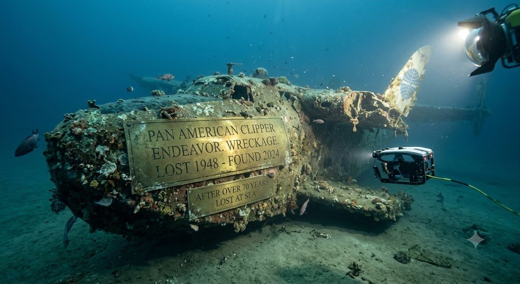
Ocean search teams recently shared new details about a rare deep water site. The new findings around the clipper endeavor underwater discovery give us a clear look at ocean history. Researchers used modern sonar to map the seabed where the ship sank long ago.
Many people follow ocean news closely. Ships from the 1800s hold clues about old global trade routes. Finding these wrecks helps historians piece together real stories from the past. You can check our latest ocean exploration news for more updates on ocean research.
What makes this site so special? It combines historical value with smart science. The wreck sits in deep water far below the surface waves. This location helped preserve key parts of the hull for over a century.
History and Background of 19th-Century Clipper Ships
Clipper ships were fast sailing vessels built during the middle of the 19th century. They had narrow wooden hulls, tall masts, and large canvas sails. Shipbuilders designed them for speed rather than large cargo space.
Merchants relied on these ships to carry valuable items like tea, silk, and spices across the globe. Getting goods to market quickly meant higher profits for cargo owners. These ships set speed records on routes between Asia, Europe, and the Americas.
The Endeavor was built in 1856 to handle these demanding ocean routes. It had heavy oak framing and copper sheets on its lower hull. Copper prevented ocean worms from eating the wooden hull in warm waters.
Long sea voyages were always risky. Bad weather, sudden gales, and rocky shores claimed many ships each year. The Endeavor ran into a severe storm during a routine voyage and sank off the coast.
For over a century, no one knew the precise location of the vessel. The crew survived on lifeboats, but the exact sinking spot remained missing from official maps.
How Search Teams Found the Underwater Site
Finding a wooden wreck on the ocean floor requires step-by-step search planning. Searchers started by reading old logbooks and weather reports from the month the ship went down. They mapped out a target area based on estimated drift patterns.
Local fishermen also helped narrow down the grid. Nets occasionally caught on unseen objects on the sea floor. Searchers plotted these net snags on digital charts to mark high-priority zones.
The survey team brought a dedicated research vessel to the area. They towed a sonar device behind the boat, sweeping back and forth in straight lines. This method covers large areas of the sea floor efficiently.
After days of scanning, the crew spotted a distinct shadow on the screen. The dimensions matched the recorded length and beam of the Endeavor clipper. A follow-up scan showed straight lines typical of human construction.
The team then deployed a small underwater drone to get visual proof. Cameras sent live video back to the boat, showing copper plating and wooden frames on the sand.
Modern Sonar and Mapping Tools Used in the Search
Ocean searches rely heavily on modern mapping technology. Side-scan sonar sends sound pulses down toward the ocean bed. Sound waves bounce off hard objects and return to the receiver, building an image from acoustic shadow patterns.
Researchers also used multibeam echo sounders. This tool measures depth across a wide strip of the seabed at once. It produces high-resolution topographic maps of underwater terrain.
To learn more about how remote devices map underwater sites, read our guide on deep sea mapping tools. These tools let scientists inspect delicate wrecks without sending human divers down.
Photogrammetry played a key role during this project. Cameras on the underwater drone took thousands of overlapping photographs. Computer software combined those photos into an accurate 3D model of the whole site.
This digital model helps scientists study the wreck down to the millimeter. It allows team members across the world to analyze the site from their computers.
Key Data and Artifact Findings from the Wreck
The survey gave researchers a clean, detailed view of the site. The ship sits upright on a flat patch of fine sand. Most of the bottom hull is well preserved under sediment layers.
Here are several key facts gathered from the initial survey:
- Water Depth: The wreck rests roughly 250 meters beneath the surface.
- Hull Structure: Oak timbers show light wear, and copper sheets remain visible.
- Artifacts: Scans revealed two large iron anchors, cargo barrels, and bronze deck fittings.
- Seabed Impact: The site shows almost no signs of human disturbance since sinking.
Cold water temperature and low light levels helped preserve the wooden structure. Wood-boring organisms grow much slower in deeper, colder ocean zones.
The table below summarizes key data points collected during the search mission:
| Data Field | Mission Finding |
|---|---|
| Vessel Name | Endeavor (Clipper Ship) |
| Construction Year | 1856 |
| Site Depth | 250 meters |
| Primary Detection Tool | Side-scan sonar and ROV camera |
| Current Legal Status | Protected maritime heritage site |
What This Discovery Means for Maritime History
Physical wrecks provide details that written historical records often miss. Finding this vessel gives historians direct evidence about 19th-century shipbuilding methods. They can examine how workers placed iron bolts and timber joints.
The location of the wreck also clarifies historical trade routes. It shows that captains took calculated risks by sailing close to offshore reefs during storm conditions.
Is the team going to raise the ship? No, experts agree the best plan is to leave it in place. Removing waterlogged wood from sea water causes rapid decay when exposed to air.
Instead, researchers will monitor the site using remote cameras. Regular visits will show whether ocean currents or shifting sands threaten the timber structure.
Marine Life and Artificial Reef Habitats
Shipwrecks quickly turn into thriving marine habitats on the ocean floor. Open sandy areas offer few places for sea creatures to hide or attach themselves. A wooden hull acts like a natural reef in deep water.
Video feeds from the drone showed soft corals growing on the iron anchors. Small fish species swim through openings in the timber frames. Sea anemones and crabs cover much of the exposed metal work.
This ecological role is another reason to leave the ship where it rests. Removing the structure would destroy a living habitat that took over a century to form.
Marine biologists plan to study the site alongside historians. They want to track how deep sea life uses wooden structures over decades.
Preserving Underwater Heritage Sites
Protecting historical wrecks from illegal looting remains an ongoing challenge. While deep sites are safer than shallow ones, illegal salvagers still pose a threat. Local authorities keep the exact GPS coordinates secret to protect the site.
International heritage laws treat historic shipwrecks as protected cultural resources. Removing items without an official permit is illegal in most waters. These rules help ensure that sites remain intact for scientific study.
Museums plan to use the 3D models to create interactive exhibits. Virtual reality setups will let visitors explore the wreck without touching a single timber. This approach keeps the site safe while sharing its story with the public.
Public interest in ocean search missions continues to grow. Finds like this show how much of the sea floor remains unmapped. Scientists estimate that hundreds of thousands of historic wrecks still rest underwater.
Frequently Asked Questions
Where is the Clipper Endeavor wreck located?
The site rests in ocean waters about 250 meters deep. Authorities keep the precise coordinates private to prevent illegal looting or damage.
When did the Endeavor sink?
Ship records show the vessel sank during a severe storm in the late 19th century while traveling along a busy ocean trade route.
Will artifacts be retrieved from the site?
Most items will stay on the ocean floor to protect their structural integrity. Researchers only recover small items if they face damage or require laboratory tests.
How do researchers map deep shipwrecks?
Teams use side-scan sonar, multibeam mapping, and remotely operated vehicles with cameras. These tools build accurate 3D models without touching the wreck.
The clipper endeavor underwater discovery gives us a fresh window into history. It shows how modern tools help us learn about our past without disturbing marine life. As sonar technology improves, search teams will likely find many more historic ships below the waves.
What ocean discoveries are you most excited to learn about next? Share your thoughts with friends and stay tuned for more sea research updates.









Leave a Reply